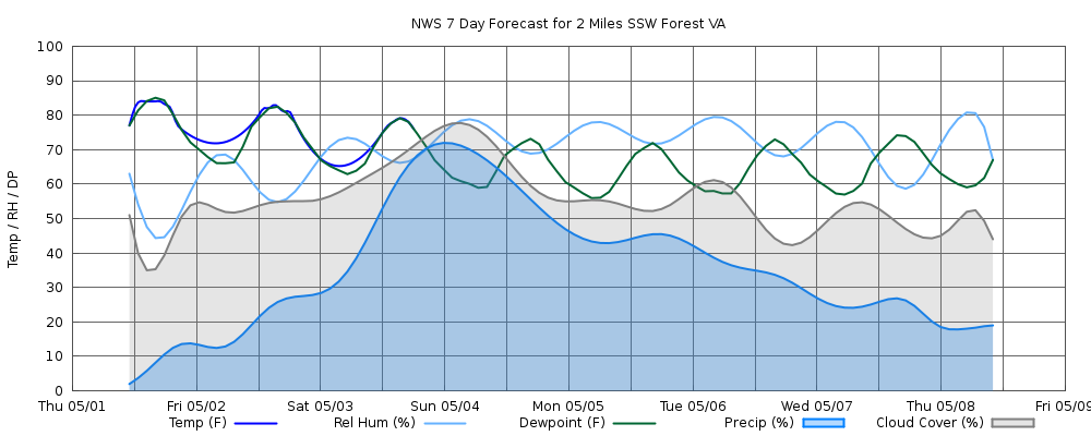
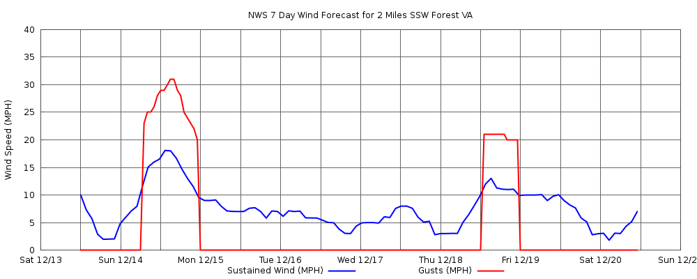
The data on this page is retrieved from the NWS forecast API via DWML and JSON. If you are interested in the code (Go and Gnuplot) that grabs and renders this data, please contact me.

NWS Tabular Daily Forecast for 2 Miles SSW of Forest, VA (37.34N,-79.29W):

Mon Jul 20
(NWS: Today)
Partly Sunny then Scattered Showers And Thunderstorms
Day: Today
Partly Sunny then Scattered Showers And Thunderstorms
H 85° • POP 33%
Chance Showers And Thunderstorms
Night: Tonight
Chance Showers And Thunderstorms
L 68° • POP 77%
Tue Jul 21
(NWS: Tuesday)
Showers And Thunderstorms Likely
Day: Tuesday
Showers And Thunderstorms Likely
H 87° • POP 61%
Showers And Thunderstorms
Night: Tuesday Night
Showers And Thunderstorms
L 69° • POP 90%
Wed Jul 22
(NWS: Wednesday)
Showers And Thunderstorms
Day: Wednesday
Showers And Thunderstorms
H 86° • POP 90%
Chance Showers And Thunderstorms
Night: Wednesday Night
Chance Showers And Thunderstorms
L 62° • POP 39%
Thu Jul 23
(NWS: Thursday)
Slight Chance Rain Showers then Mostly Sunny
Day: Thursday
Slight Chance Rain Showers then Mostly Sunny
H 80° • POP 15%
Partly Cloudy then Slight Chance Rain Showers
Night: Thursday Night
Partly Cloudy then Slight Chance Rain Showers
L 61° • POP 15%
Fri Jul 24
(NWS: Friday)
Slight Chance Rain Showers then Slight Chance Showers And Thunderstorms
Day: Friday
Slight Chance Rain Showers then Slight Chance Showers And Thunderstorms
H 80° • POP 15%
Slight Chance Showers And Thunderstorms
Night: Friday Night
Slight Chance Showers And Thunderstorms
L 63° • POP 24%
Sat Jul 25
(NWS: Saturday)
Slight Chance Rain Showers then Slight Chance Showers And Thunderstorms
Day: Saturday
Slight Chance Rain Showers then Slight Chance Showers And Thunderstorms
H 80° • POP 24%
Slight Chance Showers And Thunderstorms
Night: Saturday Night
Slight Chance Showers And Thunderstorms
L 64° • POP 23%
Sun Jul 26
(NWS: Sunday)
Mostly Sunny then Slight Chance Showers And Thunderstorms
Day: Sunday
Mostly Sunny then Slight Chance Showers And Thunderstorms
H 86° • POP 17%
Slight Chance Showers And Thunderstorms then Mostly Clear
Night: Sunday Night
Slight Chance Showers And Thunderstorms then Mostly Clear
L 66° • POP 17%

Mouse over parts of the forecast table for more detail.

NWS hourly forecast data used to produce the following graphs: data


Graphic rendering of hourly data:
Graphical Forecast 1
Graphical Forecast 2
Graphical Forecast 3