VLF DATA NAVIGATION:    N4VLF.NET    VLF Band    SID 24 Hr Data    SID 3 Day Data    Recent VLF Events   

Live VLF Station 7 Day SID Data

Live VLF Station SID data from 37.343850,-79.288216 sorted by ascending frequency. This page automatically refreshes every 15 minutes.
This data is also available in 24 hour, and 3 day intervals.


What is a SID?

SID is an abbreviation for Sudden Ionospheric Disturbance. After a solar flare on the Sun, it takes about 8 minutes for the ultraviolet (UV), x-ray and (sometimes) gamma ray radiation to hit the side of the Earth facing the Sun. The radiation is absorbed by the atmosphere, knocking electrons free. The D and E layers increase in density, which has the effect of causing complete or partial blackouts of short wave radio communications. Interestingly, the same effect that causes short wave fading enhances longer wavelength propagation (like VLF). So, you can 'see' a SID by monitoring distant VLF transmitters.

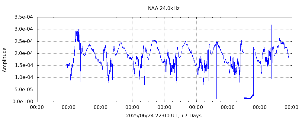
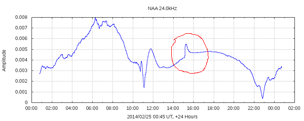
For example, here is NAA (24kHz), with a small SID around 15:15 UTC (circled in red):

SID Example

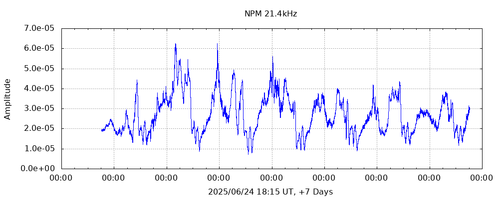
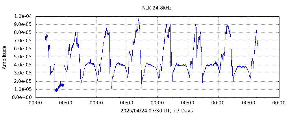
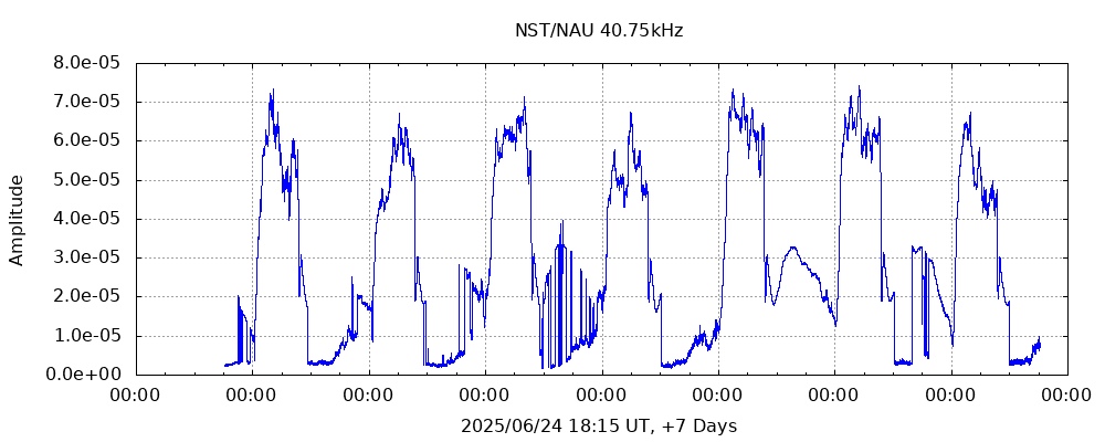
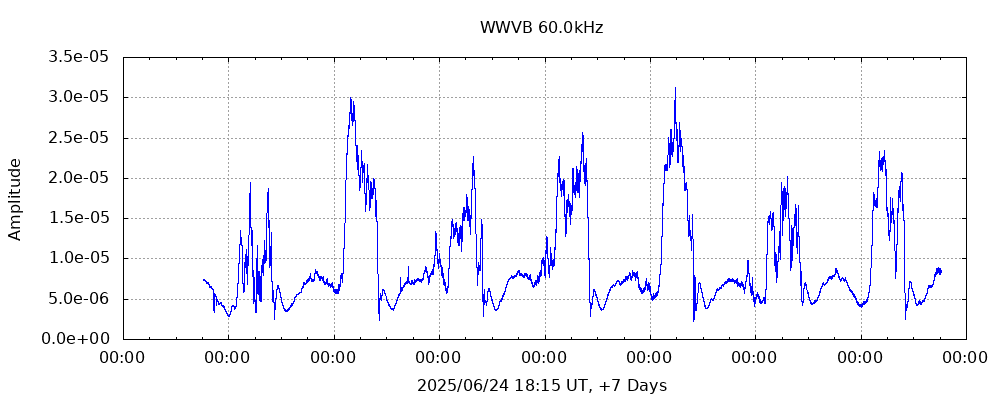
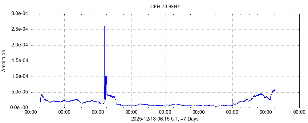
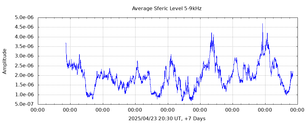
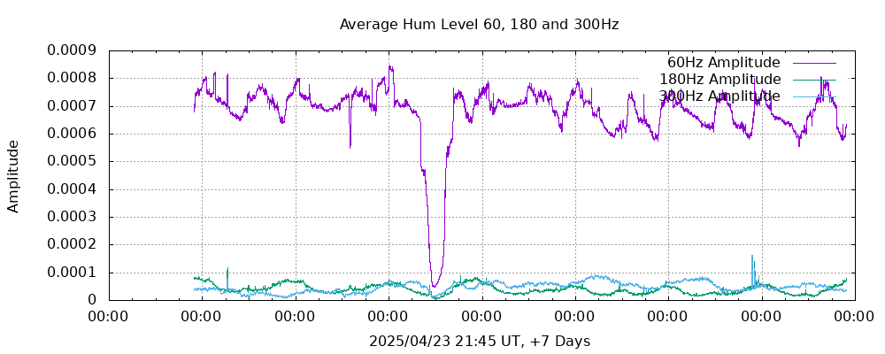
The graphs below allow monitoring for SIDs by looking for unexpected slope changes in the graphs. When it is observed in more than one graph, it reduces the likelyhood that it is an artifact limited to a specific VLF transmitter.

For more information:

Sudden Ionospheric Disturbance
The D Region
The E Region


GBZ
GBZ, Anthorn, UK. Click on image for larger version.
Distance: 5854.8 km (3638.0 mi)  |  Bearing: 44.6° | Data


NPM
NPM, Lualuahei, HI, USA. Click on image for larger version.
Distance: 7632.8 km (4742.8 mi)  |  Bearing: 281.2° | Data


NAA
NAA, Cutler, Maine, USA. Click on image for larger version.
Distance: 1292.0 km (802.8 mi)  |  Bearing: 47.3° | Data


NLK
NLK, Seattle, Washington, USA. Click on image for larger version.
Distance: 3630.4 km (2255.8 mi)  |  Bearing: 303.2° | Data


NML
NML, La Moure, North Dakota, USA. Click on image for larger version.
Distance: 1862.6 km (1157.4 mi)  |  Bearing: 308.6° | Data


NRK
NRK, Grindavik, Iceland. Click on image for larger version.
Distance: 4736.8 km (2943.3 mi)  |  Bearing: 33.0° | Data


NST
NST, Aguada, Puerto Rico. Click on image for larger version.
Distance: 2415.2 km (1500.7 mi)  |  Bearing: 147.4° | Data


WWVB
WWVB, Fort Collins, Colorado, USA. Click on image for larger version.
Distance: 2248.6 km (1397.2 mi)  |  Bearing: 287.5° | Data


FUG
FUG, La Regine, France. Click on image for larger version.
Distance: 6649.8 km (4132.0 mi)  |  Bearing: 56.3° | Data


FUE
FUE, Kerlouan, France. Click on image for larger version.
Distance: 5974.5 km (3712.4 mi)  |  Bearing: 52.3° | Data


Sfreic Intensity 5-9kHz
24 Hour Average Sferic Level 5-9kHz (click graph for larger image)  |  Data


Hum Levels 7 Day
24 Hour Average Hum Level (click graph for larger image)  |  Data


Other data sets are available upon request - Contact me


Copyright (C) 2010-2024, Mike Smith

The content presented here is the original work of Mike Smith unless otherwise shown. Please contact me for comments or errors.